Welcome to RF Propagation Tools
Professional RF Coverage Analysis Across 300 kHz to 2 GHz
RF Propagation Tools delivers terrain-aware radio frequency coverage prediction using a hybrid Fresnel-diffraction propagation model optimized for real-world accuracy.
What makes it different:
For frequencies below 30 MHz, the platform uses industry-standard ITU-R P.368-9 ground-wave propagation tables, accounting for ground conductivity, bilateral reciprocity, and diffraction loss over terrain obstacles.
Above 30 MHz, RF Propagation Tools abandons simple path-loss formulas and instead uses a sophisticated terrain-explicit model that combines:
- Fresnel-Kirchhoff diffraction — Knife-edge diffraction (Deygout method) identifies dominant terrain obstacles and calculates realistic signal attenuation
- Curved-Earth geometry — Effective Earth radius correction ensures accurate radio horizon calculations, especially critical for beyond-horizon paths
- Two-ray ground reflection — Accounts for constructive and destructive interference between direct and ground-reflected rays in the VHF/UHF bands
- Horizon diffraction — Earth-bulge attenuation is modeled explicitly for paths extending beyond the radio horizon
- VHF thickness penalty — Frequency-dependent scaling of diffraction loss captures the increased sensitivity of shorter wavelengths to terrain obstruction
The result is a model for VHF/UHF planning standard with explicit terrain modeling suitable for individual point-to-point links, rural coverage planning.
Real terrain. Real physics. Real results.
Try Free - only email required →
Watch the 2 minute Demo Video →
Featured Screenshot
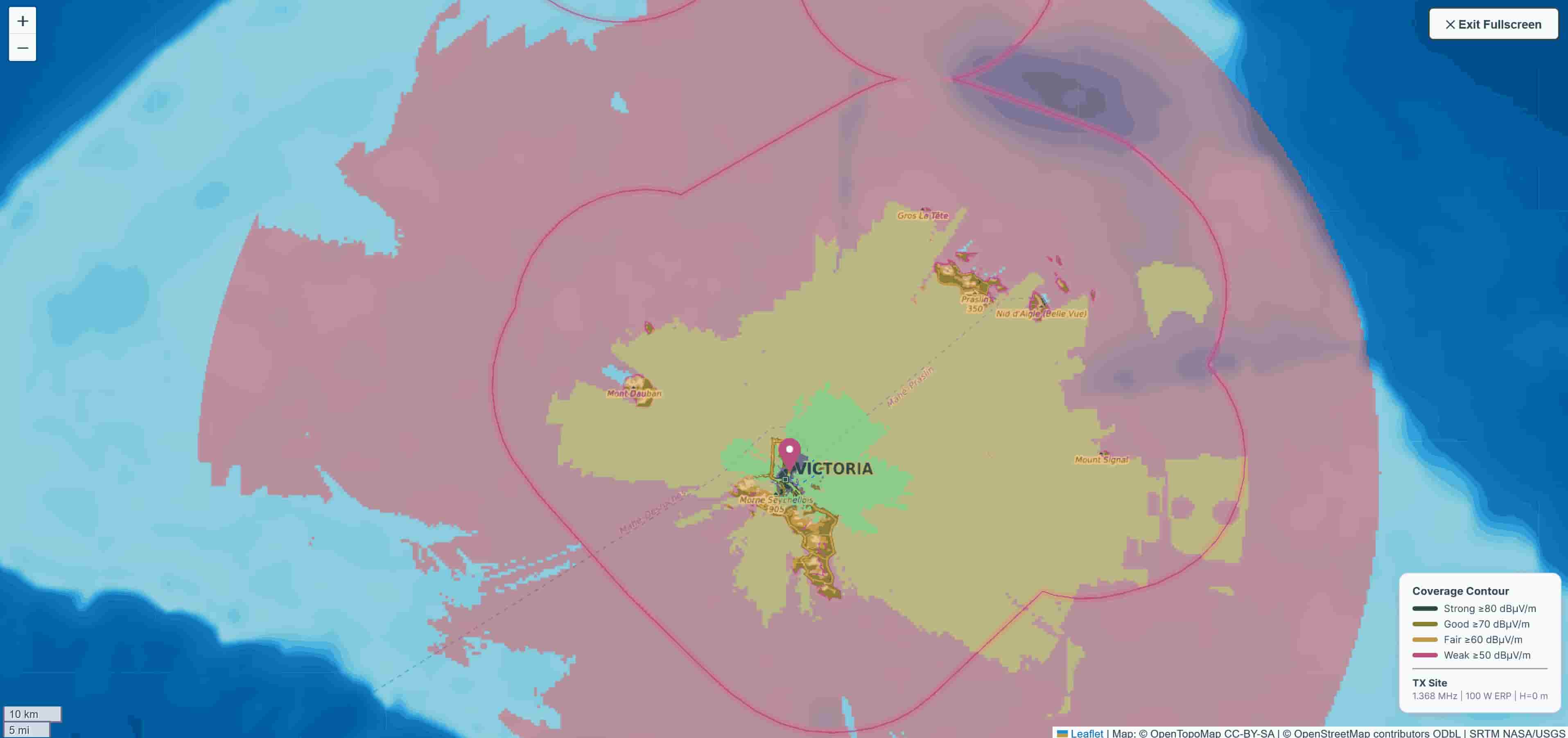
Interactive coverage map with real-time propagation modeling
Key Features
Interactive Coverage Maps
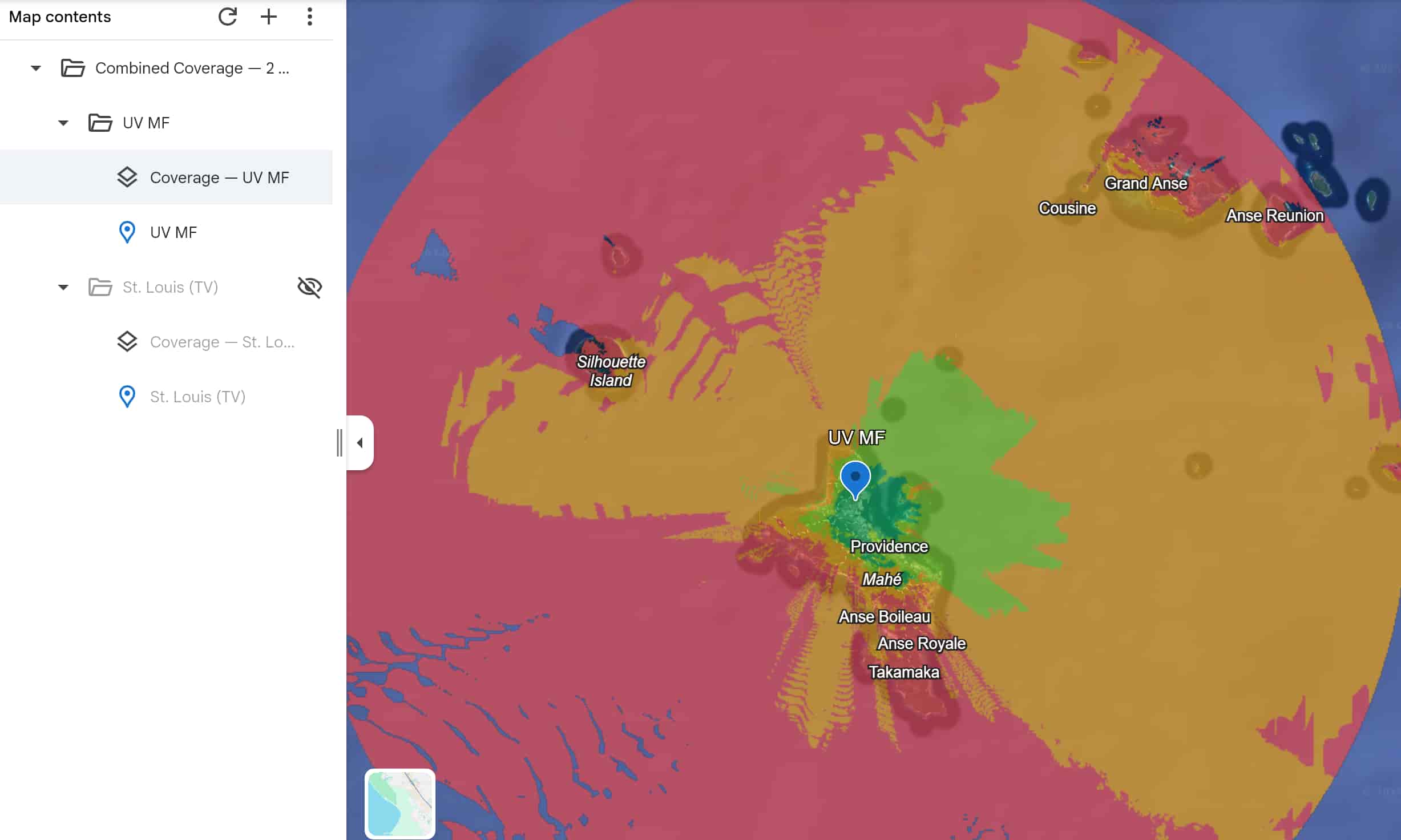
Visualize signal strength across terrain with precise contour lines. Zoom, pan, and explore coverage in real-time with elevation data and topography integration.
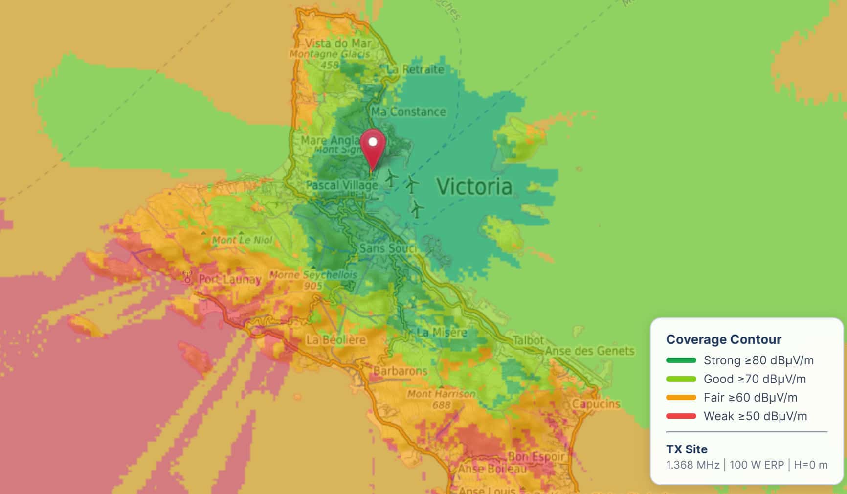
Detailed coverage visualization with signal strength contours
Terrain Analysis
Understand how terrain affects propagation. Our platform integrates SRTM elevation data and advanced terrain modeling to show realistic coverage patterns.
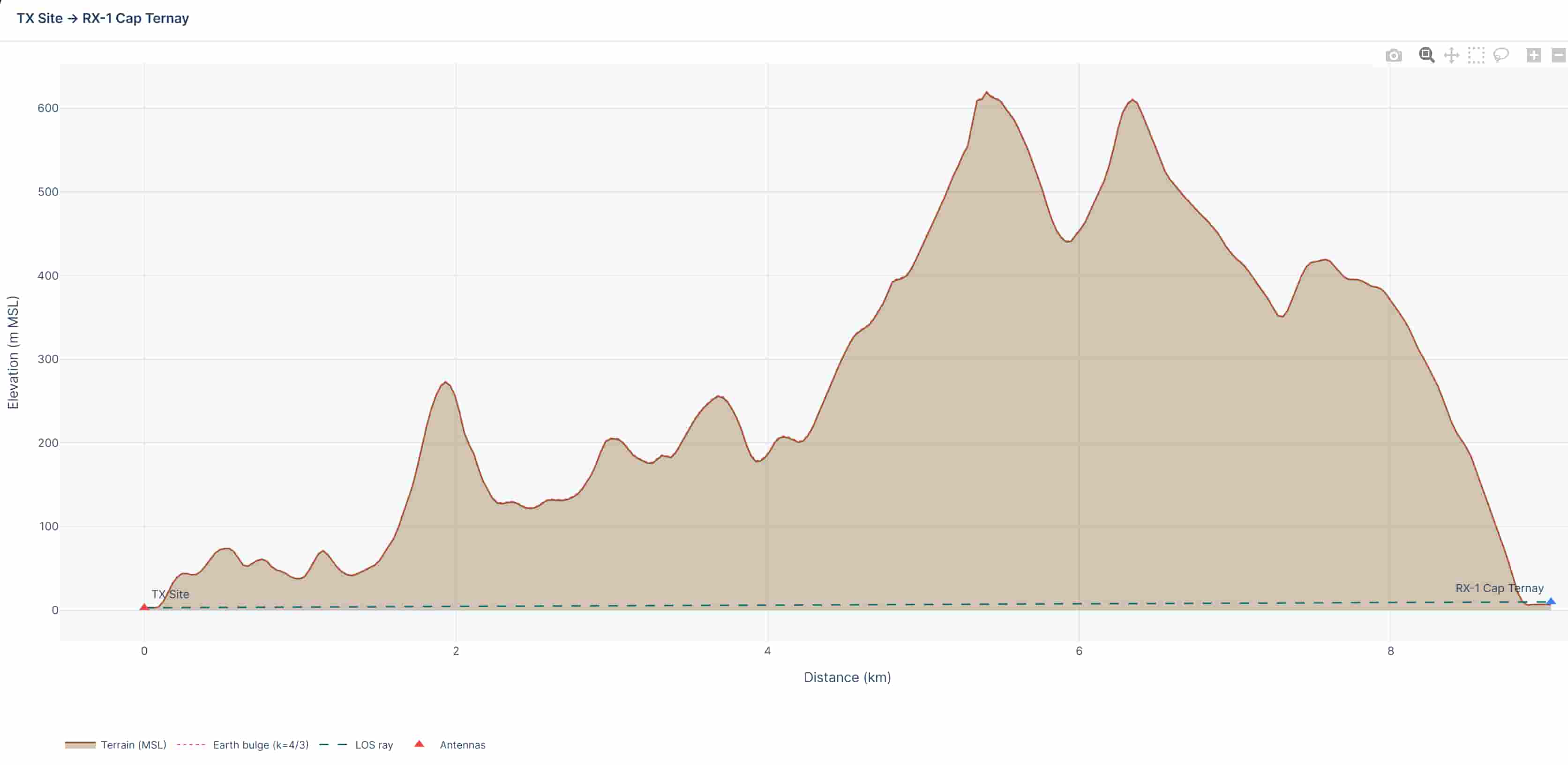
Elevation profile analysis for point-to-point links
Export Reports
Download your analysis in professional formats. Export as PDF, DOCX, or KMZ for use in GIS systems and presentations.
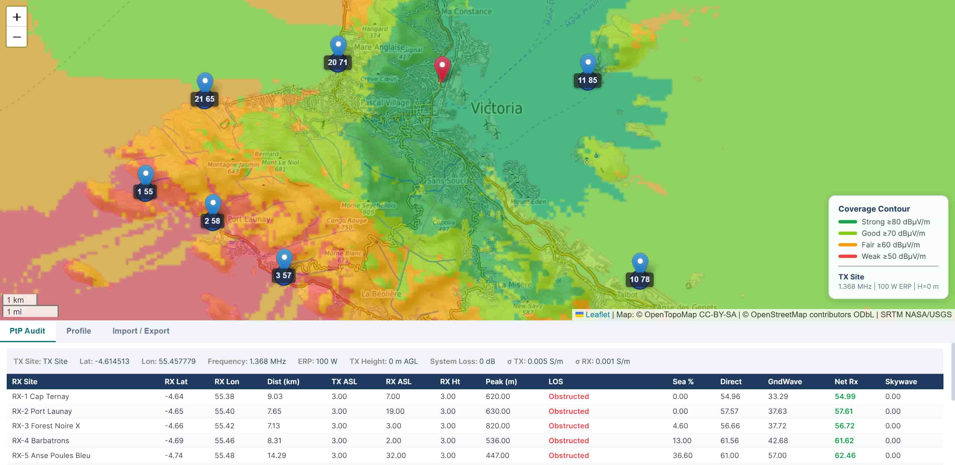
Detailed calculation results ready for export
Multi-frequency Support (300kHz to 2GHz)
Plan across the full RF spectrum. From long-wave to microwave, our models handle all frequency bands with proper propagation physics and terrain coupling.
Seamless integration with GIS and mapping tools
How It Works
- Set up your transmitter — Enter frequency, power, antenna type, and location
- Configure the environment — Select ground type, terrain model, and analysis parameters
- Generate coverage — Instant propagation calculation with terrain diffraction
- Export results — Download maps, profiles, and reports in your preferred format
Built for RF Professionals
Whether you’re planning a broadcast network, point-to-point links, or mobile coverage, RF Propagation Tools gives you the precision and speed you need.
Accuracy — Hybrid Fresnel-diffraction model with explicit terrain coupling
Speed — Coverage maps in seconds, not hours
Flexibility — Support for all RF bands (200 kHz–2 GHz) and terrain types
Integration — Export to PDF, DOCX, KMZ, and more
Ready to Get Started?
No signup complexity. No credit card. Just your email and you’re planning RF coverage.
Try Free - only email required →
Questions?
Check out our documentation or contact us for support.